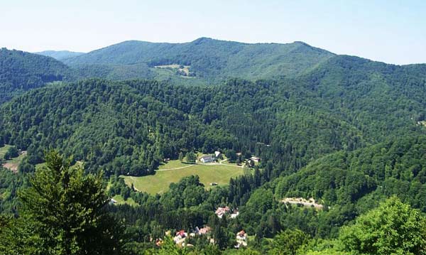
Moacşa is situated 14 km from Sfântu Gheorghe in the east, at the foot of the hill called „Oriaspince-teto”. The village Moacşa is located in the southern part of Covasna county, between the Bodoc Mountains and the Three Chairs basin.
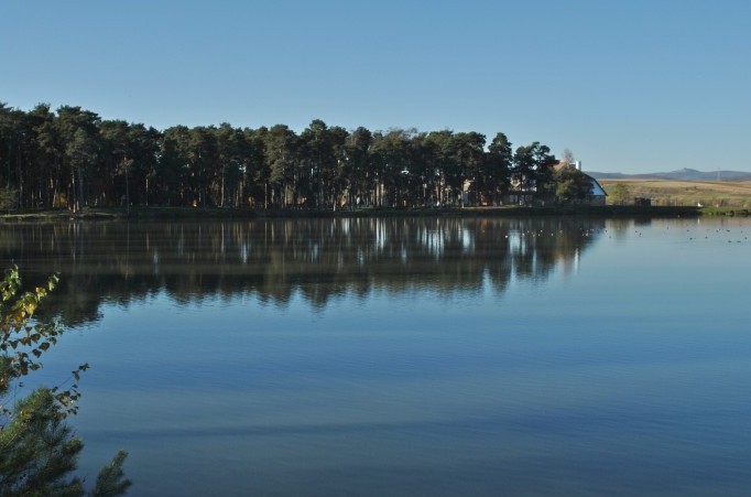
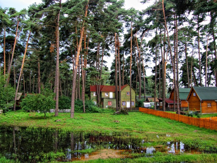
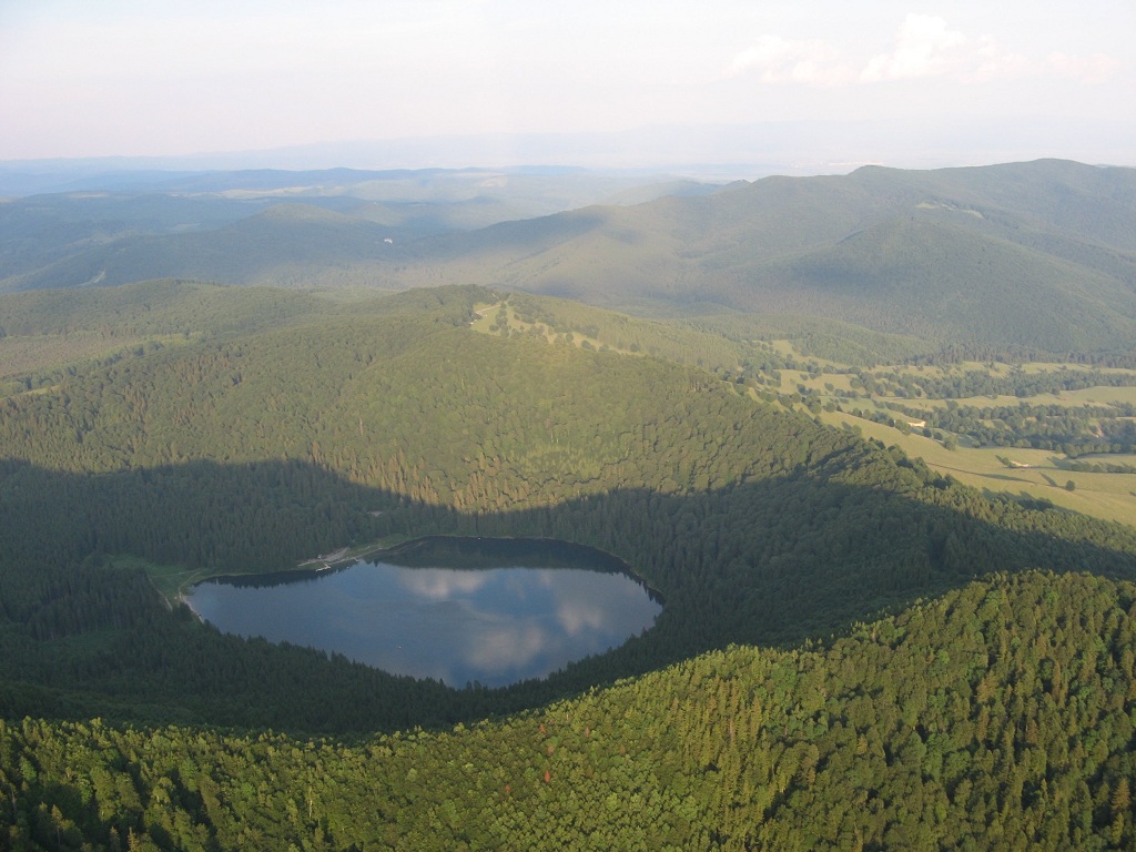
Padureni Lake
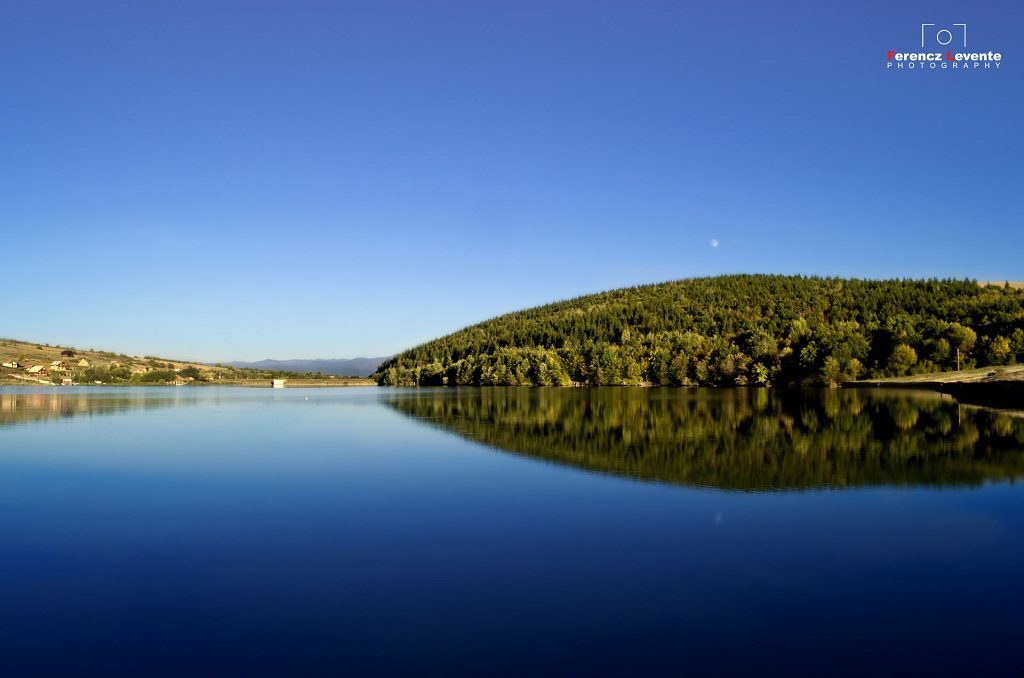
Pădureni Stream flows through the village, which upstream the village supplied the Pădureni Lake for three decades, being conceived and built for the irrigation of the lowlands area. Today Pădureni Lake is only a touristic and recreational zone.
“Gabor Aron” Monument
On the territory of Moacşa administrated by the Local Council, on the superior flow area, at a three kilometer distance from the center of the village, situates the village Pădureni and southerly from Moacşa, along the E574 (DN11) highway lies the village Eresteghin.
Near the Hill of Eresteghin is the grave of the gun-founder Gábor Áron, but from here to Northwest lies the Hill called „Oriáspince-tető”, its name comes probably from the stone graves, discovered already in the Bronze Age.
The Monument on the Hill “Big Cellar” (Oriaspince-teto) is a mountain in the middle of Three Chairs district.
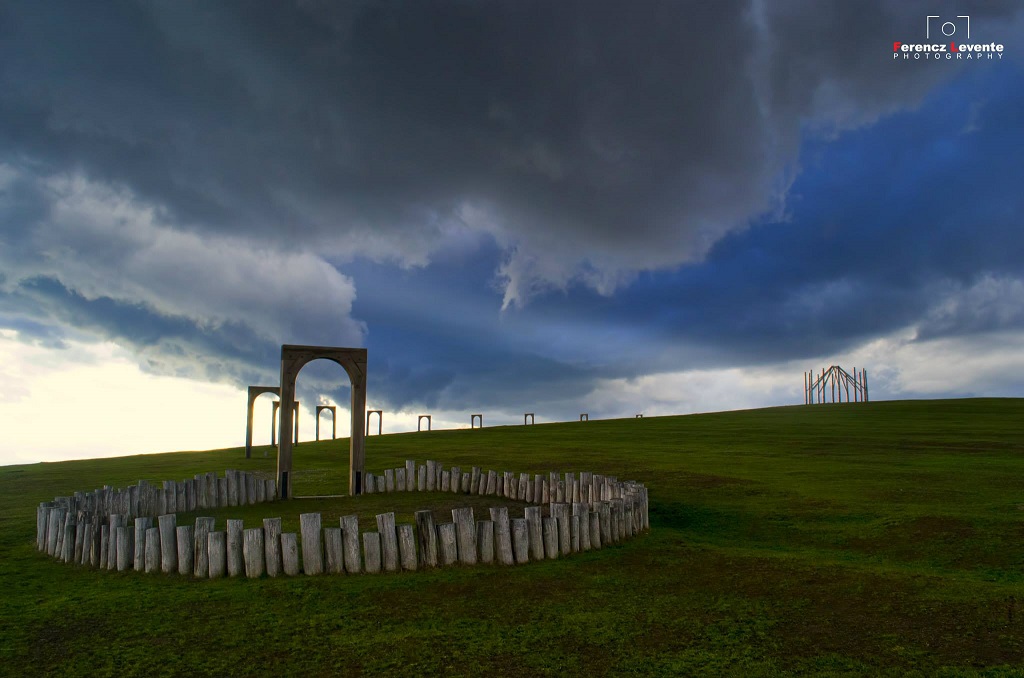
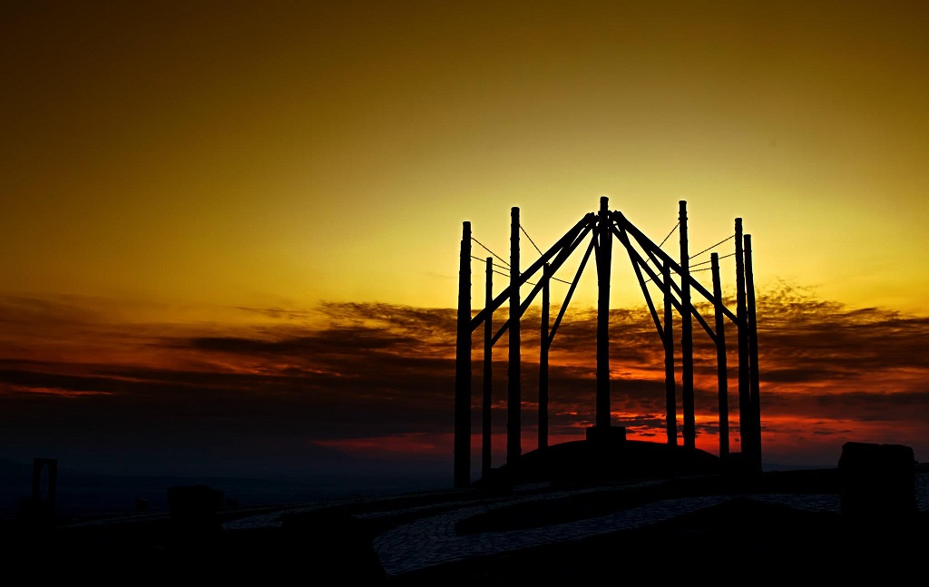
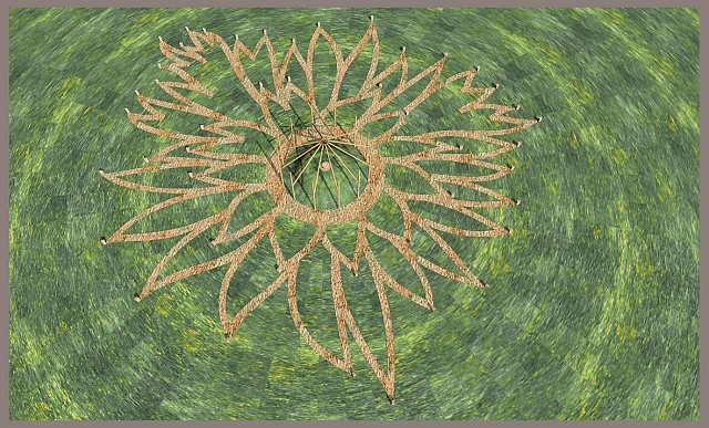
This old hillock is situated around 12 huge pines with bare trunk. From each pine comes up a branch, making a dome over the hillock. In fact, they are branches, bounded firmly with fetters and iron chains to the solid pines. Without these chains the whole structure would collapse. The chains and the iron ring with the diameter of an altar (the mark of an altar in the sky) oblige the beams to hold each other forming a dome. On the upper side of the hillock there is an another round altar-chimney made of stone, that should be burnt 12 times a year, on the day graved in the threshold stone of each station. (these 12 gates are on the path leading to the monument).These dates are historical anniversaries of the people in the area of Three Chairs. The monument is situated in the middle of the stone path system having the form of a flame in the direction of each locality. At the end of each pathway there is a cliff in which is graved the name of the locality and the date with its first written registration.
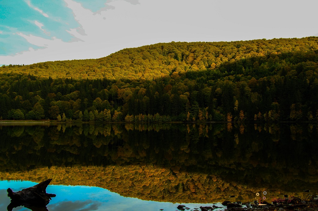
Birch Tree Forest and Lake Reci
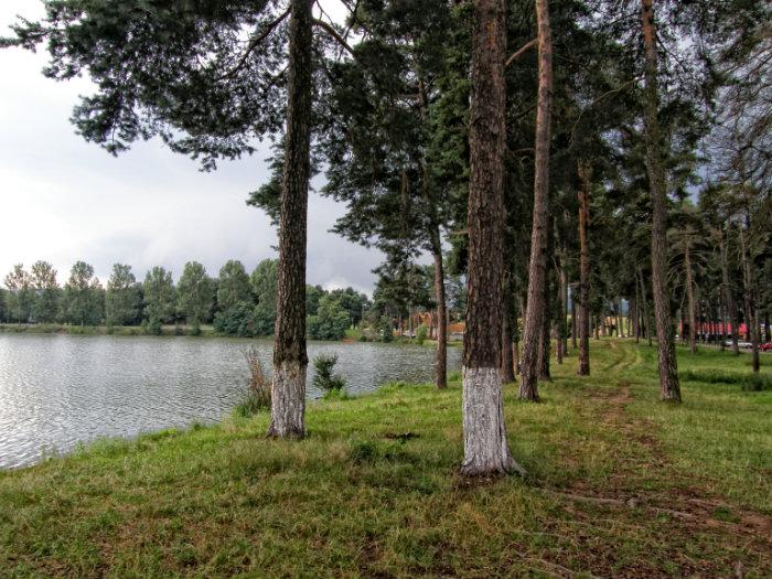
Distance: 6.5 km (6 minutes)
It is a natural reservation located in the central-eastern part of Covasna county. A reservation having about 34 Sq. m surface, situated in the bed of Negru River, affluent of the Olt River. Along the Negru River are to be found sand-hills, some of them rising up to 6 m. In the reservation there are lakes and eutrophic swamps, populated by a series of rare species, glacial relicts, such as mountain pine, angelica, but also of rear fern species, water-lily, Snakes Head Fritillary, etc., as well as animals, such as the blue poison dart frog. In the reservation there is at the same time a rear species of plantation, the so called pinus banksiana, which is able to tolerate extreme conditions.
This fabulous landscape attracted an American film director in this natural reservation in order to shoot the film Cold Mountain (2003) with Nicole Kidman and Jude Law.
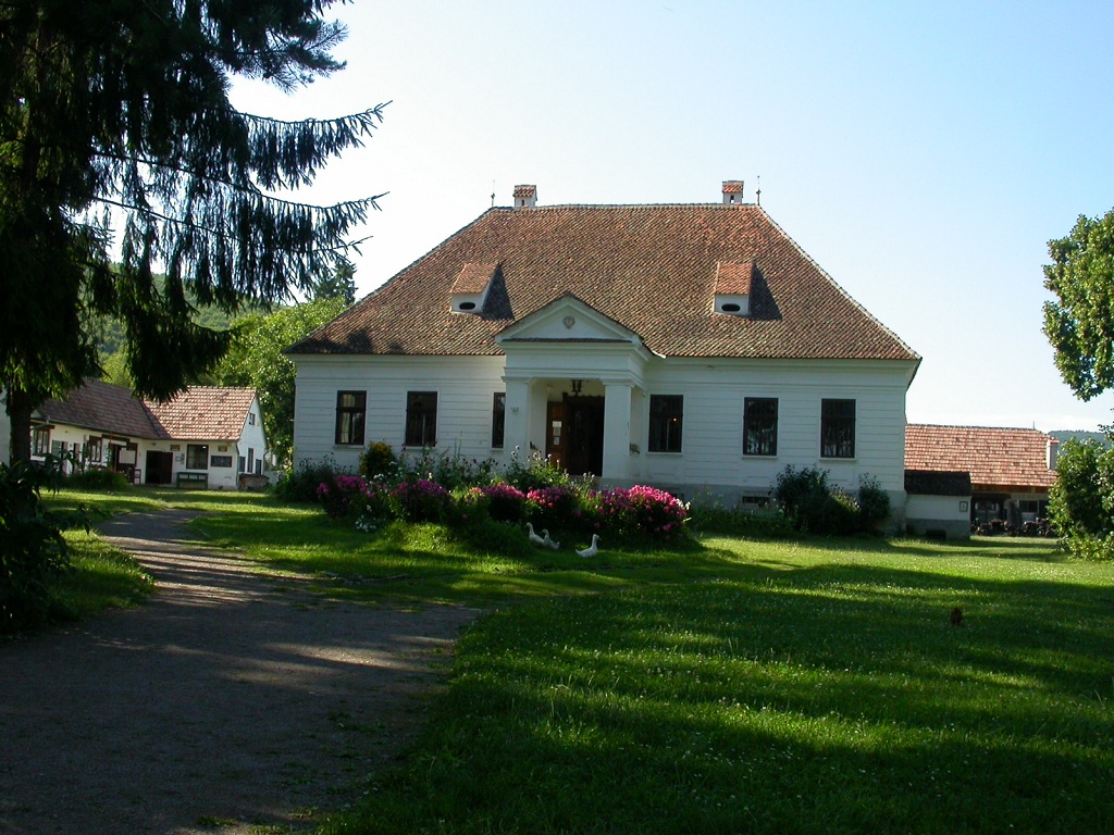
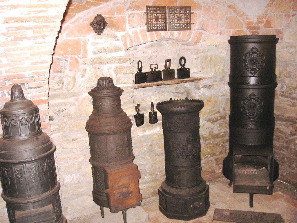
The Ethnographic Museum Haszmann Pal – Cernat
Locality: Cernat (11 km, 9 minutes)
The best known attraction of Cernat village is the Museum, founded in 1974, representing the most beautiful pieces of folk art in the superior area of Three Chairs: Székely furniture, tiles and textiles.
The building of the museum is in the middle of an open-air exposition, including monumental gates, restored buildings and mills, a collection of funeral monuments of stone and sculptured wood, as well as an exposition of machines and agricultural instruments.
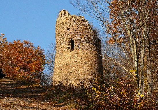
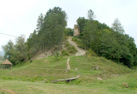
Ika castle– The Broken Tower – Cernat
Locality: Cernat, Covasna county
At the margin of the village Cernatul de Sus, aloft of the confluence of the streams Mare and Ika, which flow in the Cernat River, situates the Broken Tower of Cernat, known as Ika castle.
The latest name entered into the public consciousness due to Orban Balazs, who associated this castle with the legendary hero called Ika. Long ago, the narrow and stony mountain was crowned by a medieval 200 m long and 10 m wide fortification, having an elongated form. On the two inner heads of the wall there were two towers, out of which exist only the ruins of the southern tower, having 13 m height.
The archeologists of the National Szekely Museum consider that this fortress was built in the 13th -14th centuries. Taking into consideration that there is no regal propriety in the area, this fortification was probably built by particular or community initiative. It was probably left at the beginning of the 15th century.
Various legends relate to the fortification and its construction. The millers in the area of the fortification have preserved a tradition, according to which in the cellars of the building are large amounts of gold and diamond treasures. It is very difficult to enter there, the entrance being guarded by two cocks. While the one is sleeping, the other is awake. If somebody arrives in the near of the entrance the cock begins to sing, and at the same time the iron door is closed.
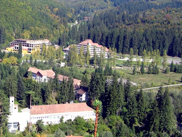
Balvanyos Resort

Locality: Balvanyos (about 41 km – 38 minutes)
The Balvanyos Resort is a permanent health resort which lies at an altitude of 775-800 m on the southern slopes of the Bodoc Mountains. The mineral waters from here are indicated for the treatment of cardiovascular diseases, asthenic neurosis, gastritis, etc. The resort began to develop after the year 1895.
- one can visit the Killer Cave (Sulphurous Cave or Stinking Cave), with first written registration from 1349 (existent in the inferior part of a carbon dioxide layer, result of post volcanic emanations, determining the death of any living creature which enters here);
- or the ruins of the Pagan Citadel (X- XIII centuries) – on the left bank of the Balvanyos River, on a hill are the ruins of the Balvanyos Citadel made of a quadrate donjon, connected to a stone place of an inner fortress which contains also the plateau, and an exterior fortress linked with the western edge of the fortress. On the eastern side is situated the entrance into the fortress. On the basis of the construction elements and the discovered materials the donjon was placed between the 12th-13th centuries, while the stone” room” in the 13th -14th centuries. The fortress was populated up to the 17th century.
Lake Saint Anne
Distance: about 54 km (57 minutes)
The Lake Saint Anne is the only crater-lake in Romania located in Harghita county, in Ciomat Mountains, near the River Olt, in the neighbourhood of Tusnad. The lake is situated in the volcanic crater named Ciomatu (or after other sources Ciomadu) from the Puciosu Mountain (Stinky Mountain) the place with the most volcanic eruptions of the Carpathians and Eastern Europe, which took place about ten thousand years ago (probably 42.000 years ago).
The Saint Anne Lake is situated at 946 m altitude. It has an almost circular, funnel-shaped form, is 620 m long and maxim 460 m wide and it has an area of 19,50 Sq.m. The maximum depth of the lake is 7 m. The lake is supplied from precipitations, having no other sources. The water purity approaches of that of distilled water, with only 0.0029 ml mineral. The reduced trophic capacity of the lake’s water is due to the vapor emanations from the bottom of the lake and through the walls of the crater.
The tourists who came to Saint Anne Lake don’t need the prognoses of the meteorologist in order to find out the weather forecast, having an empirical, but exact method at disposal, offered by the volcanic mountain: both fissures formed in the mountain that forecast the weather. The inhabitants know that “If the emanations from the fissures are pinching the nose, then it is signaled the approach of a storm, if not, the day will be bright, just convenient for taking a trip.”
This phenomenon has also a scientific explanation. In the mountain there is a post-volcanic activity, sensitive to any atmospheric pressure change. When the atmospheric pressures lowers, the gases, as well as the carbon dioxide and the sulphure are rising to the surface and inundate the fissures with a pinching smell, a sign that it will be raining.
The Saint Anne Lake is a complex natural, geological, flora and fauna reservation, being linked with Tusnad with touristic paths.
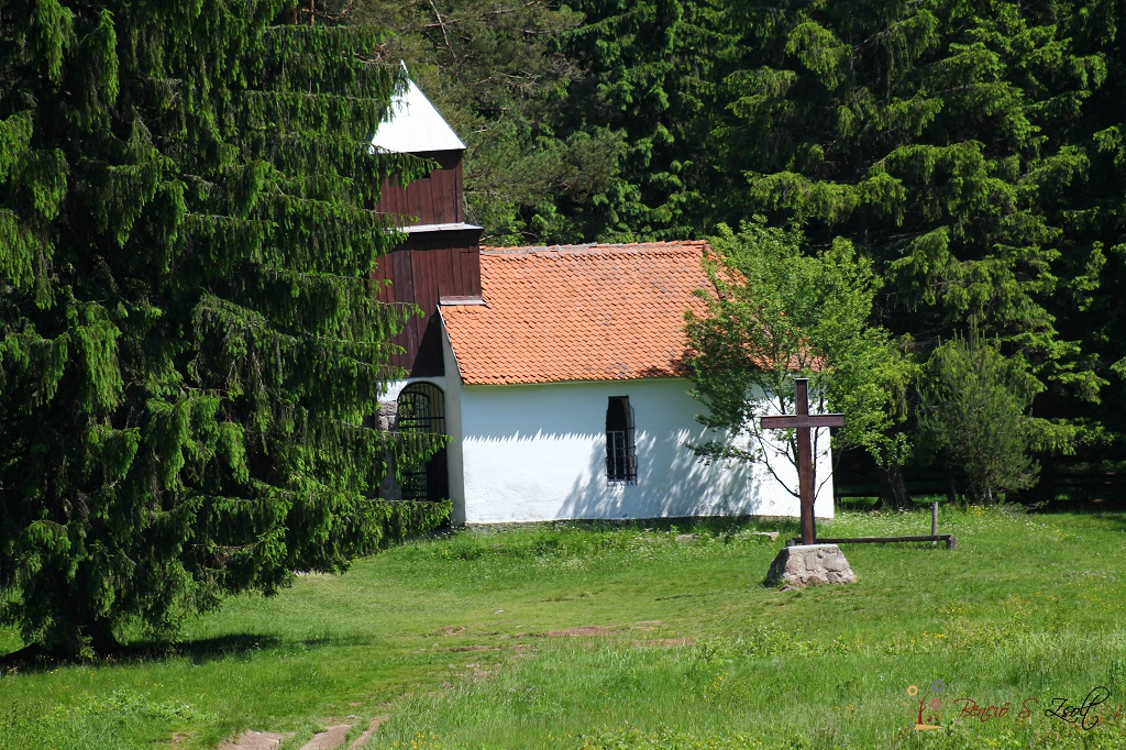
Near the lake there is a Roman Catholic chapel dedicated to Saint Anne.
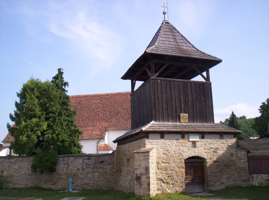
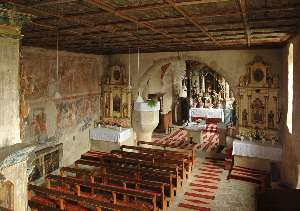
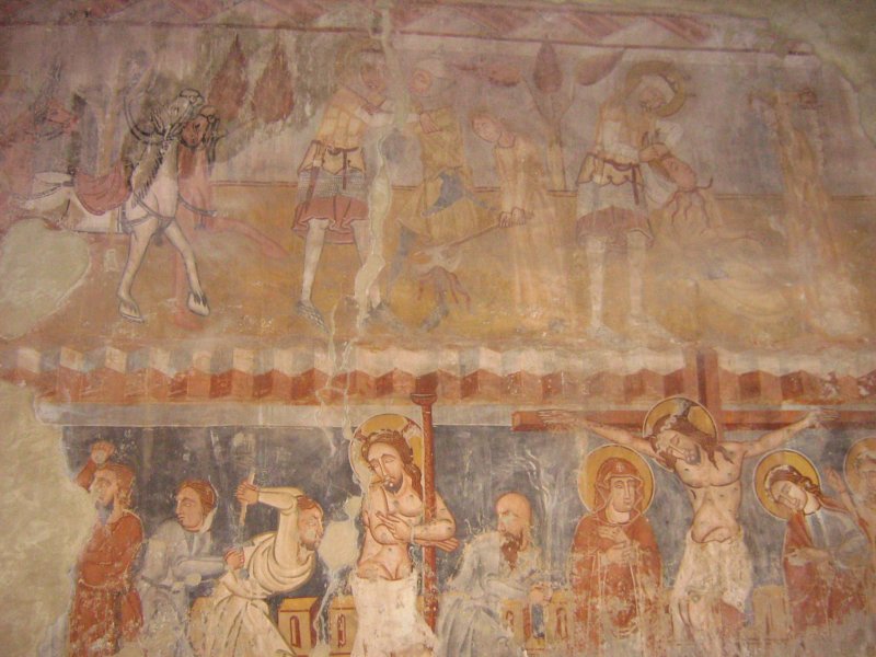
The Roman Catholic Church (frescoes of Ghelinta)
Locality: Ghelinta
Distance: 31 km (27 minutes)
The old building, built in Roman style of the Roman Catholic Church of Ghelinta village was extended in the 15th century, but in the interior of the building were preserved the frescoes executed at the beginning of the 14th century. The coffered ceiling in Renaissance style was painted in 1628.
A unique richness of the church are the frescoes on the three walls of the building (the north, the western and the southern one), representing different scenes of the legend of Saint Laszlo, dating from 1330 – 1340. Among the frescoes of Sf. Laszlo there is another line of frescoes presenting elements of the legend of Saint Catherine of Alexandria. The church was declared by UNESCO as part of the global cultural heritage
Covasna Resort
Locality: Covasna (about. 21 km)
Documented under its actual name from 1567 Covasna Resort is guarded by not so high mountains, with round summits, and benefits from a pleasant climate with cold summers and moderate winters. In summer and autumn the sky is shinny and the days are bright, competing with the localities from the eastern and south-eastern of Romania. The resort is situated 35 km far from Sfantu Gheorghe, 60 km from Brasov and 250 km from Bucharest.
Due to the specific geological conditions, Covasna is rich in various mineral waters and natural CO2 emanations. In 1882, the mineral water coming from the Horgasz Spring won a medal at Trieste. The researches made across the time by researchers and specialists, as well as on the basis of the medical treatments, placed Covasna among the most important health care resorts. Consequently Covasna is a health resort with a tradition of treating cardiovascular diseases with natural factors. It is situated at 600 m altitude, in the junction of the Carpathians. This resort benefits from natural factors: carbonated mineral water, natural mofetta (post-volcanic emanations of carbon dioxide), as well as a climate, rich in negative air ions, existing due to the pine trees in the neighborhood. The variety of the health natural factors, as well as its facilities in the treatment base of Covasna, offers the possibility of the simultaneous treatment of numerous affections, which confers the great complexity of the resort.
Therapeutic recommendations:
- DISEASES OF THE CARDIOVASCULAR SYSTEM
- DERMATOLOGICAL DISEASES: psoriasis, chronic eczema, allergic affections, neurodermatitis
- DISEASE OF THE DIGESTIVE TRACK AND GLANDS(inner treatment): hypoacid chronic gastritis, hyperacid chronic gastritis, after-effects of gastric resections, recurrent ulcers of gastritis, functional disorders and chronic intestinal inflammation affections, chronic enteritis and colitis, gastrointestinal dyspepsia, post-operative sequels after epidemic hepatitis, pot-operative sequels of the biliary duct, dyskinesia of the biliary duct, hypo-functions of the biliary duct, cholelithiasis.
- ENDOCRINOLIGICAL DISEASES: Basedow disease, hyperthyroidism, parathyroid insufficiency, hypo-functions of the endocrine glands
- LOCOMOTOR DISEASES: degenerative chronic rheumatism, abarticular rheumatism, incipient rheumatism, inflammatory rheumatism (rheumatic polyarthritis, spondyloarthritis, except of the inflammatory flares), affections of the intervertebral discs
- RENAL DISEASES AND AFECTIONS OF THE URINARY TRACK: chronic glomerulonephritis e, chronic pyelonephritis of infectious origin, kidney stones (uric , phosphatic, oxalic) chronic inflammatory diseases of the urinal track
- NERVOUS SYSTEM DISEASES: affections of the perypheric nervous system (radiculitis, polyradiculoneuritis, post-traumatic sequels of the perypheric nervous system), sequels after cerebral vascular accidents, asthenic states or neurotic reactions
- OCCUPATIONAL DISEASES: occupational chronic diseases through physical agents – occupational dermatosis, allergic reactions of different etiology, skin affections caused by physical agents.
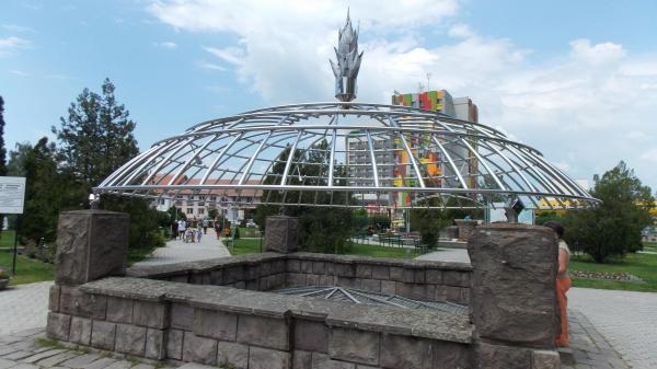
Devil’s Swamp
Locality: Covasna
Symbol of the town, Devil’s swamp is a gas eruption (carbon dioxide and sulphur) officially inaugurated in 1881, but initially used for treatments, due to which the town became one of the important health resorts of the country.
According to the tradition in 1700th this phenomenon of nature was situated in North, but enigmatically moved to the center, and left behind a smaller “Devil’s Swamp”.
The Devil’s Swamp is after the geologists’ opinion a carbon dioxide emanation: the mineral and surface water, coming from the depth, are mentioned by the whirling gases. In the 19th century the volcano erupted on several occasions: in 1837, 1857, 1864 and 1885, in 1837, being the largest eruption. At present the Devil’s Swamp is altogether harmless and resembles a kind of fountain. The last eruption took place in 1984.
The Cascade of Siclau
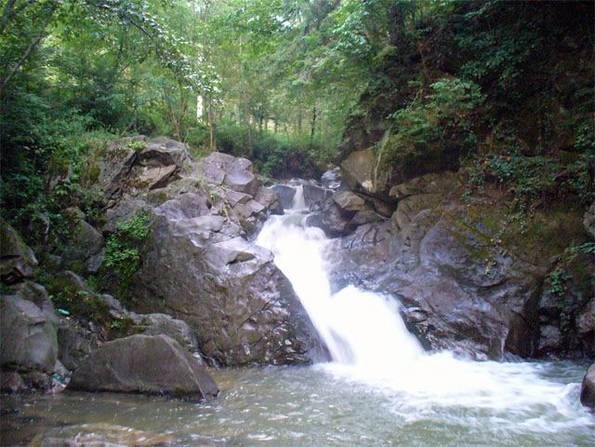
Locality: Covasna
Inclined plane system
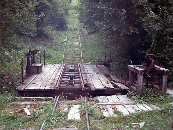
Locality: Covasna
A unique technical monument situated in county Covasna, in Covasna town, in the area of the Fairy’s Valley. The inclined plane system or the funicular, as it is called by the local inhabitants, was built on the initiative of David Horn by the engineer Emil Lux in 1886. The object was completed by the baron Groedel. This inclined plane operates with a gravity driver system to transport wagons loaded with wood on a slope without operating with other energy sources. In spite of the fact that it operates from 1889, its official inauguration took place only in 1890. The mock-up of this exceptional technic monument was presented at the universal exposition in 1896.
The technical data of the plane are: level difference between the top and bottom station: 327 m, span: 1450 mm, wire-drawing cable with the diameter of 28 mm. Its components were ordered by the Austrian company Obach.
Its operational principle is the following: the inclined plane operates with two platforms each having 3 meter wide and 6 meter long, being attached to each other with a 28 mm thick cable and a complex system of pulley actioned from the drivers’ cabin from the superior part of the inclined plane. When on the upper platform was put a loaded wagon, on the lower platform there was an empty wagon. The weight of the loaded wagon pulled up the empty wagon as it descended from the top. In the middle of the plane the two wagons avoided each other, coming into being a bifurcation of the rails. The whole process was controlled from the brake cabin from the upper part of the inclined plane.
The volume of wooden material transported at the time when the inclined plane was functioning at its whole capacity, it approached to 30 wagons on 10 cube meters. The transportation of passengers was made occasionally at the beginning of the century when the traffic conditions between Covasna and Comandau were difficult. But in the last period the functioning of the passenger transport on the inclined plane was strictly forbidden.
On the inferior end of the plane the wagons were lowered on platforms and formed lifts of trucks being trailed by locomotives to the railway station of Covasna where they have been transferred to a railway with normal span.
On the superior end the wood arrived on the narrow railway track, on this occasion from Comandau. Existed here steam engines, too, carrying woods from the superior basin of the River Bâsca. These narrow railway tracks were lying over tens of kilometers, across rivers and valleys, even across the Goru Mountains, up to the small variant of the inclined plane. At the inauguration it was the most important narrow railway system in the Carpathians unifying three major components: horse drawn wagons, the inclined plane and steam engine locomotives.
In 1995, as a result of the storms in Covasna county, the inclined plane was affected too, but not enough to be damaged. On the 17th of May 1997 the driver’s cabin on the upper side of the inclined plane was destroyed by a forest fire. Due to the interventions of the workers the cabin was reconstructed and was functioning to 1999 when because of the wood cutting reductions, the inclined plane was put aside for conservation.
At present the inclined plane is not functioning, but it can be visited occasionally on the railway track Covasna – Subşiclău (Inclined plane). Occasionally a steam engine is used in front of the carriage (for tourists).
Forestly railway
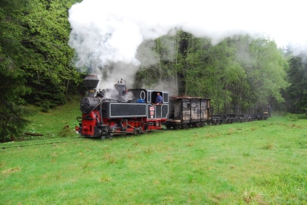
Locality: Comadau
Forestry railway used for wood transportation together with the inclined plane system in Comadau and Covasna
Fairy’s castle
Locality: Covasna
On the Miske Hill, at a distance of 3 km from the center of the town are the ruins of the Mikse Castle (or the Fairy’s Castle). There is no reliable information about the origin of the castle, but according to popular beliefs there was once a fairy called Ilona who lived in the castle and hid an immense treasure in its vaults. The secret entrance was permanently guarded by a vigilant cockerel which only fell asleep once in every seven years. By the time the bird was asleep one might open the doors and run away with the diamonds stored there.
Zanelor’s castle
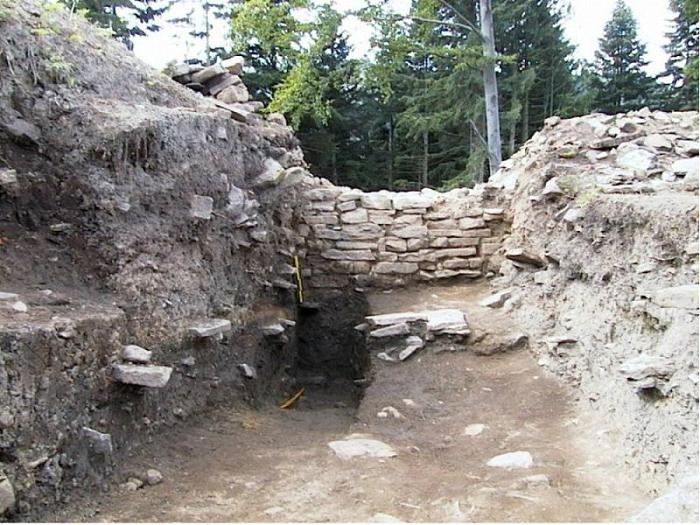
Locality: Covasna
At present are visible the walls excavated by the archeologists. The researches made here explored numerous fragments of ceramics and coins dating from the Dacian and Roman periods. The researchers consider that the fortress was built long before the period mentioned above.
The way to the fortress takes about 2 hours in some unmarked forest roads, but there are also some abrupt road-sections, which is not recommended for those who have inadequate physical condition.